
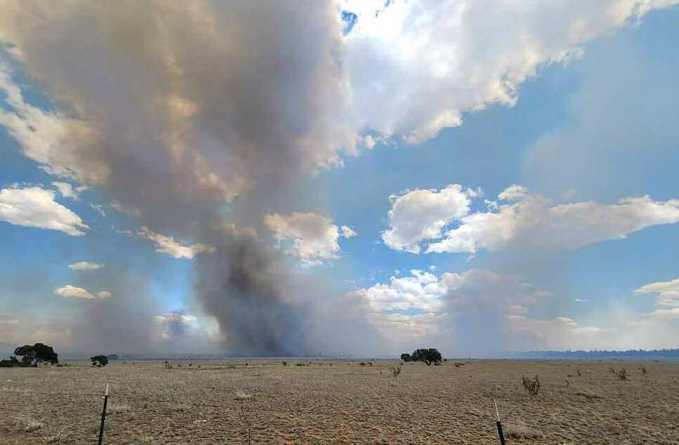
GRANTS, NM – The Encerrita Fire has remained at 2,456-acres following very little activity on Monday, currently the fire is still zero percent contained but according to an El Malpais National Monument press release the number is not reflective of the amount of work that has gone into establishing containment features on the north and west sides of the fire.
Fewer firefighters are staffed at the Encerrita fire and it is expected to remain on the current landscape. With fewer firefighters and less severe fire weather, El Mapais staff wrote that the complexity of the incident has decreased. Firefighters will continue staffing the fire and will be monitoring for potential increases in fire activity. Despite the fire being zero percent contained crews have said that due to the broken nature of the landscape among the lava flows where the fire is located it is difficult or impossible to establish control features in many locations around the fire. Due to this, the containment percentage of the fire will remain well below 100 percent for the duration of the fire.
On June 15, National Park Service staff discovered a lightning-caused fire burning on El Malpais National Monument lands. The Encerrita Fire, reported by the Oso Look- out, is located approximately 15 miles south-southwest of Grants, NM. On Monday, June 17 there were approximately 60 firefighters working on the, at the time, 1,000-acre fire.
Thursday June 20
The Encerrita Fire was 2282-acres following a 3-acre gain due to higher humidity that followed a frontal passage. Firefighters were aided by high humidity and lighter winds while they continued to secure line and focus efforts on keeping the fire south and east of Highway 53, and they continued line construction from the southwest corner of the fire to the Continental Divide Trail and eventually to Highway 53 to the fire’s western edge. Heavy precipitation aided crews from Thursday and through the weekend.
Friday, June 21
Due to the heavy rainfall firefighters were able to take advantage of favorable weather conditions to continue building and improving line to the east and north where they were able to tie into lava fields, with little to no burnable vegetation. Firefighters were also able to make progress toward constructing a line toward the Continental Divide Trail and Highway 53.
Saturday, June 22 Heavy precipitation significantly decreased fire activity and allowed firefighters to make good progress toward securing line and keeping the fire from crossing Highway 53, firefighters also worked toward tying in existing line with natural features as the weather permitted. The previous issued “Ready” evacuation notices for residents north of the fire was also rescinded.
Sunday, June 23
A helicopter assigned to the incident flew the fire’s perimeter and observed minimal smoke and fire behavior. Firefighters continued line construction on the north and west sides of the ire and patrolling the fire edge closet to Highway 53. Firefighters also continued to monitor the weather and changing conditions.
Monday, June 24
Firefighters patrolled established fire lines and monitored areas where interior fuels are consuming. An infrared flight provided fire managers with added intelligence on the fire, showing scattered heat throughout the fire area. No areas were anticipated to threaten fire lines or other containment features.
Tuesday, June 25
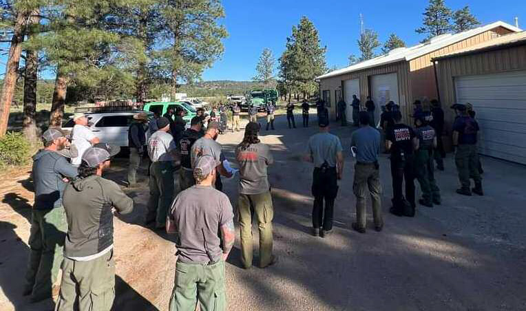
Due to the fire being less complex a Type Four incident commander will assume command of the fire on Wednesday, June 26, to direct the resources still assigned on the incident. The crews that remain on the incident will continue hauling equipment and patrolling the fire’s northern and western edges. El Malpais National Monument notified individuals that their update on June 25 will be the last formal update of the Encerrita Fire unless significant fire activity occurs.
CLOSURES
Closures will remain in effect in the monument. The Continental Divide Trail and Zuni-Acoma Trail are closed in the El Malpais National Monument from Porter Ranch Road off Highway 53 to Highway 117. A Continental Divide Trail bypass is in place between Continental Divide Trail miles 502.5 to 512.5. More information is available on the Continental Divide Trail website. Both the western Zuni-Acoma Trail parking lot and the easter Acoma-Zuni Trail parking lots are included in the closure. Closures have been posted and the public is asked to avoid closed roads, trails, and parking lots. The El Calderon Trail remains open.
Periodic updates on the fire will be provided via the El Malpais National Monument Facebook page ElMalpaisNPS, and on Inciweb. Please contact the El Malpais Visitor Center at 505-876-2783 for additional updates on the fire or changes to closures within the monument.