
Cibola County has a long history with airways and aviation dating back to the 1920s.
In the early 1920s, according to Bob Roland, a member of the Cibola County Historic Society, the route airplanes used would go from New York to San Francisco.
Because it was further north, the winter caused issues, so they searched for another route. Los Angeles to New York was decided on, making it cross through the skies of central New Mexico.
People often turned their eyes to the skies, hoping to see one of the amazing creations known as “the airplane.”
These early planes were often military flights, or federal flights on their way to deliver mail. Since they planned to use a plane-and-train system, the people in charge of finding where to move it decided it would be easier to use the Santa Fe Railroad.
Charles Lindbergh, the first person to fly alone across the Atlantic Ocean worked with Transcontinental Air Transport, after he earned his fame in 1928, making this new airline even more popular. These men were now able to fly to their destination, take the first train, and get onto the Santa Fe train.
Little did they or the plane watchers know, the Mid-Continental Airway Route crossed over what would later become known as Cibola County.
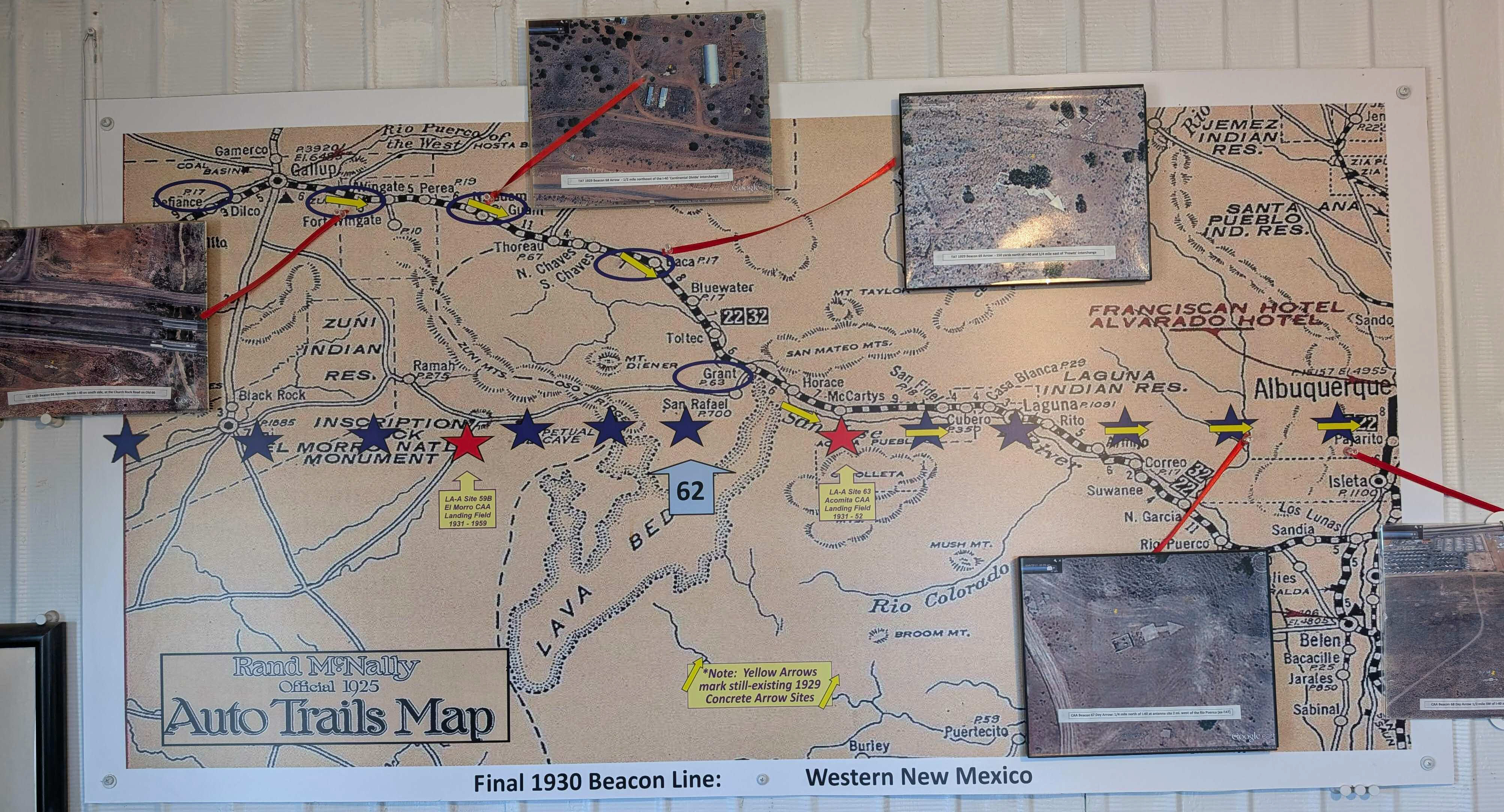
Roland explained that each sight was a 50-foot tower with a rotating airway beacon, used to flash the location is Morse Code.
In 1930, despite Transcontinental Air Transport winning a major air-mail contract route, they had to merge with their competitor, Western Air Express. Due to the merging of the two companies, they became Transcontinental and Western Air, though some remembered it as “The Lindbergh Line.”
The navigation system was replaced again in 1931 with the radio navigation system. This system required radio signals to match, so airway beacons were made to extend from Albuquerque, across Oso Ridge, into the Zuni Mountains, and onto Arizona.
The Transcontinental Air Transport plane-andtrain system lasted less than two years.
Coast-to-Coast flights became the new system when the four-course radio beam signal was created.
However, many of the usual passengers did not like this new system, as they missed the trains.
Throughout the decade, there continued to be progress. After World War II, air traffic increased.
Civilian, commercial, and Military flights passed above the skies of what is now Cibola County.
Airfields such as Greater Grants and Anaconda were expanded and with land donated by the Salvador Milan Family, and the Grants-Milan Municipal Airport was constructed in 1952.
It was during the early months of 1953 that the government flight serve operation was moved into this new airport, after the closure of the Acomita airfield.
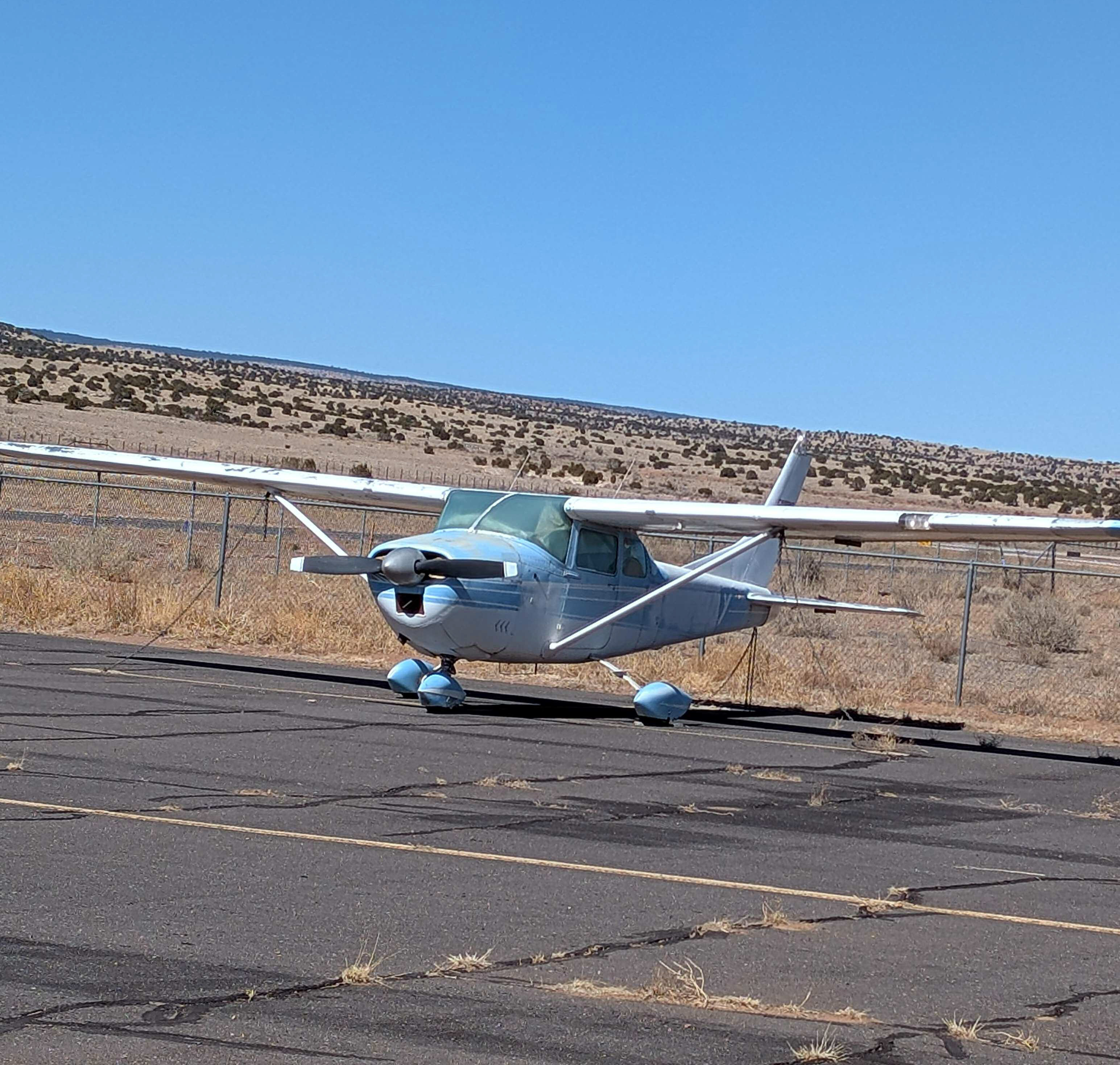
With the establishment of this airport, many citizens of both Grants and Milan reportedly began to learn how to fly an airplane and would buy airplanes.
The 1960s seemed to bring a rush of airplane buyers and hangar renters.
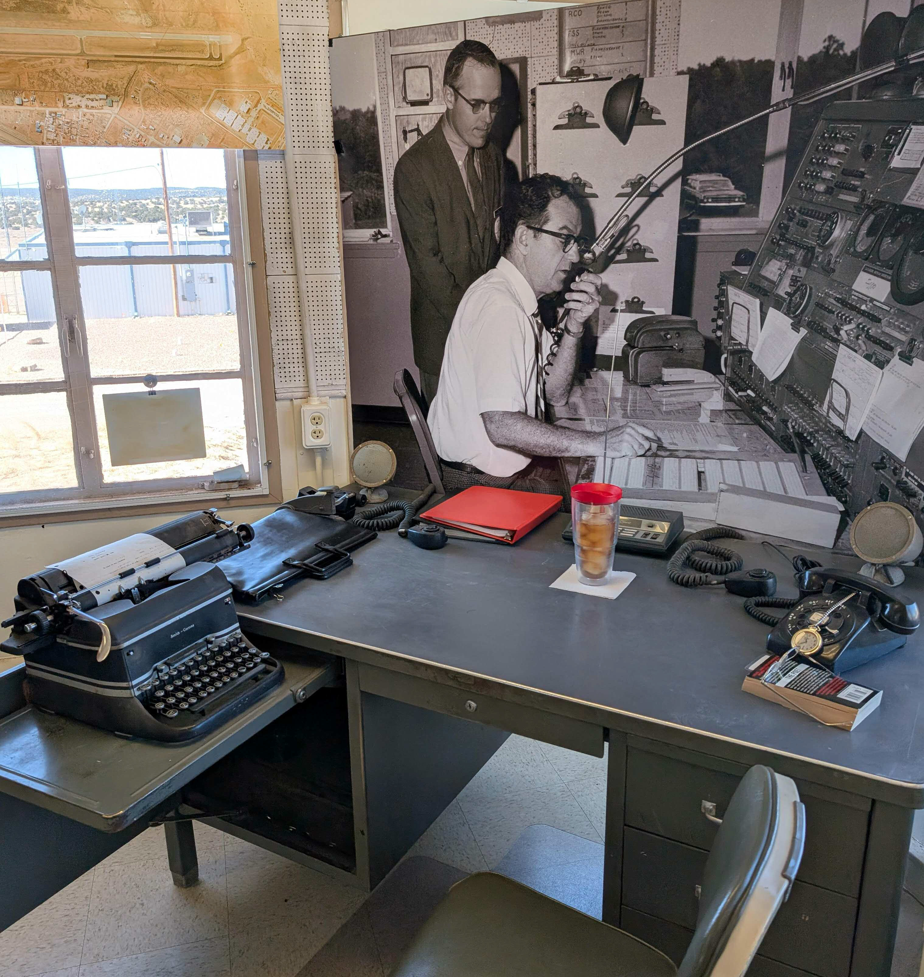
This Grants Federal Flight Service Station was operated all day, every day, according to Roland until it closed in 1973.
After the closure of the outdated system buildings, the Flight Service Station was used for storage and other aviation-related buildings were sold, removed, or abandoned.
The FSS held runway signs, lights, and aircraft parts, along with over sixty stadium lights. The property was unkept and the building suffered weather damage for years.
After rainstorms, when the building was drenched, the painted letters spelling out Grants could still be seen in 2010.
Despite the rough condition, there were various ideas of what to do with the structure. None of them happened, until 2004, when a local pilot and historian had a suggestion. He thought they could turn it into a small aviation museum, with meeting space, and a pilot lounge.
One of the members from the City’s Airport Board was able to get the City Council on board with preserving the building. However, they did not take any action at the time.
During that time and extending into 2005, the Mt. Taylor Ranger District worked to maintain the early modern history of man’s utilizations and impacts. The Mt. Taylor archeology team recorded old railroad routes, which sit in the Zuni Mountains and discovered a crash which had occurred in 1929.
Throughout the year of 2010, volunteers were able to discover a handful of beacon sights that were used in 1929, from Los Angeles to Amarillo, which had been the LAA airway. The only airway beacon structure to be found on this expedition was the generator shed for beacon sixty-one, which was located at Oso Ridge, along the Continual Divide.
The CCHS Airways Heritage Museum conducted surveys which led to the accidental discovery of the LA-A Beacon Site 62 generator shed.
During the year 2010, volunteers encouraged the creation of an airway history museum at the Grants-Milan Airport. The Cibola County Historic Society voted to initiate planning. Towards the end of the year, the City of Grants, Village of Milan, and Cibola County passed resolutions to support the CCHS in their plans for a museum.
It was during that year and the following year that the Flight Service Station, generator shed for beacon sixty-one, and a beacon tower were decided to be included in the museum.
The Cibola Aviation Museum is the only site in the county that includes a restored 1929 airway beacon tower, concrete route arrow, 1931 metal route arrow, and a 1952 Flight Service Station, all of which played important roles in American aviation.
The report concerning the 1929 crash, along with many other crashes and success stories can also be found at the museum.
This Museum showcases the rich history of aviation, with many stories concerning well known pilots and local aviators, who lived or moved to Cibola County.
There is no admission fee, and it is self-guided.
In order to preserve these important pieces of history, donations are encouraged.