
Repeated September rains soak Cibola County as lake, river readings edge lower
CIBOLA COUNTY, N.M. – Repeated rounds of September rain have soaked portions of Cibola County, but the latest measurements show water levels continued to edge downward at both Bluewater Lake and the Rio San Jose during the past week.
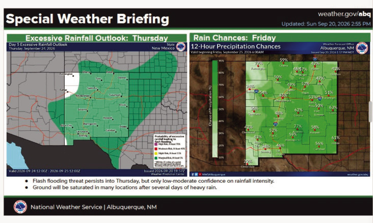
Another round of potentially heavy rainfall is now moving into western New Mexico, giving the county another opportunity for beneficial moisture – along with renewed concerns about flash flooding and hazardous travel.
Bluewater Lake
According to provisional U.S. Geological Survey data, Bluewater Lake stood at an elevation of 7,364.15 feet Tuesday morning, Sept. 22.
That is down 0.10 feet from the Sept. 15 reading of 7,364.25 feet.
The continued decline is notable after several days of monsoon rainfall across the region.
Rio San Jose
The Rio San Jose at Acoma Pueblo measured 1.95 feet Tuesday morning, according to provisional USGS data.
That is down slightly from 1.96 feet on Sept. 15.
Precipitation Across Cibola
A sustained stretch of monsoon rainfall brought repeated rounds of moisture to Cibola County during the past week, leaving soils increasingly wet and keeping the threat of flash flooding elevated across western New Mexico.
On Sept. 17, a Flash Flood Watch covered the West Central Highlands as the National Weather Service forecast widespread showers and thunderstorms capable of producing rainfall rates of 1 to 2 inches per hour. Forecasters expected rain during the afternoon and evening followed by another round of lighter to moderate precipitation overnight.
By Sept. 18, the concern was no longer simply how much rain an individual thunderstorm could produce. The National Weather Service reported that soils across portions of western and northern New Mexico were already very wet following several days of rainfall, meaning additional precipitation could more readily become runoff.
Another Flash Flood Watch was issued that day, with stronger storms capable of producing 1 to 1.5 inches of rain per hour. Arroyos, ditches, low-water crossings quickly filled.
Bluewater Lake fell 0.10 feet from Sept. 15 to Sept. 22, while the Rio San Jose at Acoma Pueblo slipped from 1.96 feet to 1.95 feet.
Now another substantial round of moisture is arriving.
A new National Weather Service Flood Watch is in effect from noon Tuesday, Sept. 22, through 7 p.m. Wednesday, Sept. 23, for much of western New Mexico. The New Mexico Department of Transportation warned Tuesday morning that heavy rainfall could produce flash flooding, standing water, debris, reduced visibility and possible road closures.
“Flash flooding can happen quickly and create dangerous conditions with little warning,” NMDOT District Six Engineer Lisa Boyd Vega said. “If you encounter water crossing the roadway, do not attempt to drive through it. Turn around and find another route.”
Water data courtesy of the United States Geological Survey. Temperature, precipitation and drought information courtesy of Drought.gov, the National Weather Service, the U.S. Drought Monitor, the Climate Prediction Center and the New Mexico Environment Department.