
Storms brought exceptional rainfall to parts of the county, drove the Rio San Jose sharply higher and disrupted schools as local governments responded to widespread damage
CIBOLA COUNTY, N.M. – A series of powerful October storms brought extraordinary rainfall to Cibola County, flooding homes, damaging roads, isolating rural communities and forcing school closures as local governments mobilized emergency resources.
The storms, which intensified Thursday, Oct. 22, and continued through the weekend, produced rainfall that exceeded the statistical threshold for a 100-year event in portions of the county, according to an analysis by local meteorologist Rob Carver.
The flooding prompted emergency disaster declarations by Cibola County, the City of Grants and the Village of Milan, while the Rio San Jose rose sharply and Bluewater Lake gained more than a foot in one week.
Exceptional Rainfall Across the County
The National Weather Service began issuing severe weather alerts Thursday morning, including a Tornado Watch for Cibola and surrounding counties at 11:10 a.m.
Severe Thunderstorm Warnings followed, with some storms capable of producing 60 mph winds and quarter-sized hail. By the afternoon, Flash Flood Warnings covered communities including Prewitt, Grants, Milan and San Rafael.
The weather intensified when the National Weather Service issued Tornado Warnings for northeastern Cibola County, including areas near Cebolletita, Seboyeta, Paguate and Encinal. Radar indicated rotation capable of producing a tornado, although no touchdown was confirmed in the information available to the Cibola Citizen.
Carver's subsequent analysis identified radar-estimated rainfall reaching approximately 7.8 inches over two days north of Paguate, along with a band exceeding four inches from south of Acomita toward Interstate 40.
According to his analysis, approximately 4% of Cibola County received rainfall exceeding the local 100-year, 48-hour precipitation threshold.
That designation means the estimated rainfall amount has a 1% chance of being equaled or exceeded in any given year at a particular location. It does not mean such rainfall occurs only once every century.
The estimates represent localized radar-derived measurements rather than countywide totals.
Flooding Damages Homes and Infrastructure
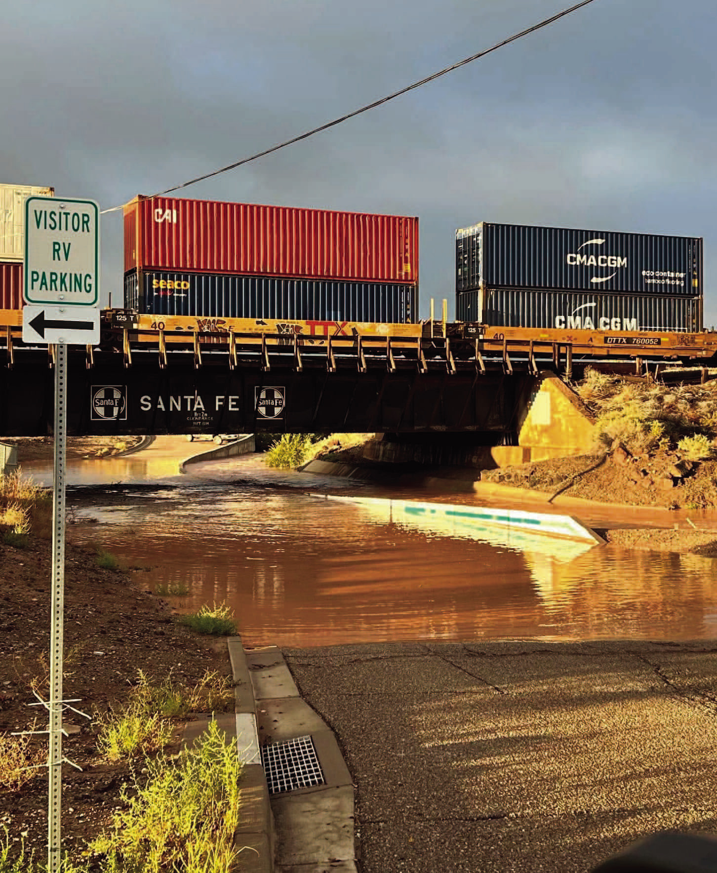
The rainfall sent substantial runoff into the Rio San Jose and surrounding drainage systems, threatening neighborhoods in Grants and Milan.
In Grants, officials reported breaches along river embankments that contributed to flooding near Sargent, Devine, MacArthur and Nimitz.
City crews repaired at least one breach and reinforced vulnerable areas as additional runoff approached. Fire personnel conducted door-to-door notifications, advising residents in threatened neighborhoods to prepare for possible evacuation.
The Cibola Citizen observed significant flooding near MacArthur Avenue and Nimitz Drive Friday morning. The San Jose Bridge area was also inaccessible because of high water.
In Milan, Village Manager Candi Williams reported that neighborhoods near San Jose, Milan Street and Victor were placed on evacuationready status. One household voluntarily evacuated.
The Bluewater area experienced substantial residential damage. County officials reported flooding affecting approximately a dozen homes, while the county's disaster declaration described more than a dozen residences impacted.
Floodwaters also damaged roads, culverts and lowwater crossings throughout the county, complicating travel and emergency access.
Rio San Jose and Bluewater Lake Rise
Provisional U.S. Geological Survey measurements illustrate how rapidly local waterways responded.
At Acoma Pueblo, the Rio San Jose measured approximately 1.90 feet early Thursday, Oct. 22. By 6 p.m., the river had reached 4.23 feet, an increase of approximately 2.33 feet.
The river subsequently receded, measuring 2.33 feet Tuesday morning, Oct. 27, although it remained above its pre-storm level.
Bluewater Lake also experienced a substantial increase.
The lake's elevation rose from 7,363.98 feet Oct. 20 to 7,365.02 feet Oct. 27, an increase of 1.04 feet, or approximately 12.5 inches.
Despite the improvement, the lake remained 4.39 feet below its elevation recorded Oct. 28, 2025.
In the Zuni Mountains, the Rice Park SNOTEL station recorded approximately 2.5 inches of additional precipitation over the week, bringing its water-year total to 2.9 inches.
The increases represent a significant change in local water conditions but do not eliminate longer-term drought concerns.
Flooding Disrupts Schools and Isolates Communities
Grants-Cibola County Schools canceled classes as flooding made travel unsafe across rural and Pueblo communities.
Superintendent Lane Widner told the Cibola Citizen Monday that road conditions prevented some employees from reaching schools, creating concerns about adequate staffing and student supervision.
“Requiring students to attend would have resulted in partial attendance and insufficient staff to safely supervise them,” Widner said. “We felt it was best to make up instructional time when all students could attend and learn alongside their teachers.”
According to Widner, Cubero was inaccessible from Saturday until approximately 1 p.m. Monday, while San Mateo remained inaccessible from Friday through Monday.
Some school grounds experienced flooding, but no district buildings flooded. Natural gas service was also unavailable in Seboyeta.
Despite the closures, GCCS distributed grab-and-go lunches to more than 500 students and families Monday.
“We wanted to ensure families had access to meals even though students were not attending school, particularly those affected by flooding or experiencing financial hardship,” Widner said.
The superintendent reported that the meal distribution did not create additional district costs, although other potential financial impacts remained under assessment.
Recovery Efforts Continue
Cibola County, Grants and Milan made emergency disaster declarations Friday, Oct. 23, authorizing the mobilization of resources, emergency repairs and requests for potential state and federal assistance.
The declarations do not automatically guarantee disaster funding or reimbursement.
Local officials continue assessing damage to homes, roads and drainage infrastructure as recovery efforts proceed.
The storms delivered substantial moisture to a region that has experienced prolonged drought concerns, but they also demonstrated the consequences of extraordinary rainfall arriving over a short period.
As floodwaters recede, the full extent of the damage and the cost of recovery remain to be determined.